A new interactive tool accessible to the solar, heliospheric and planetary science communities to track solar storms, streams and energetic particles in the heliosphere.This tool was defined and developed by IRAP and IAS staff through a subcontract with Akkodis and CNES financial support. It follows on from and is complementary to the propagation tool developed by the FP7 HELIO project.
Main functionalities are described in the reference paper recently published in Planetary and Space Science.
The propagation tool allows users:
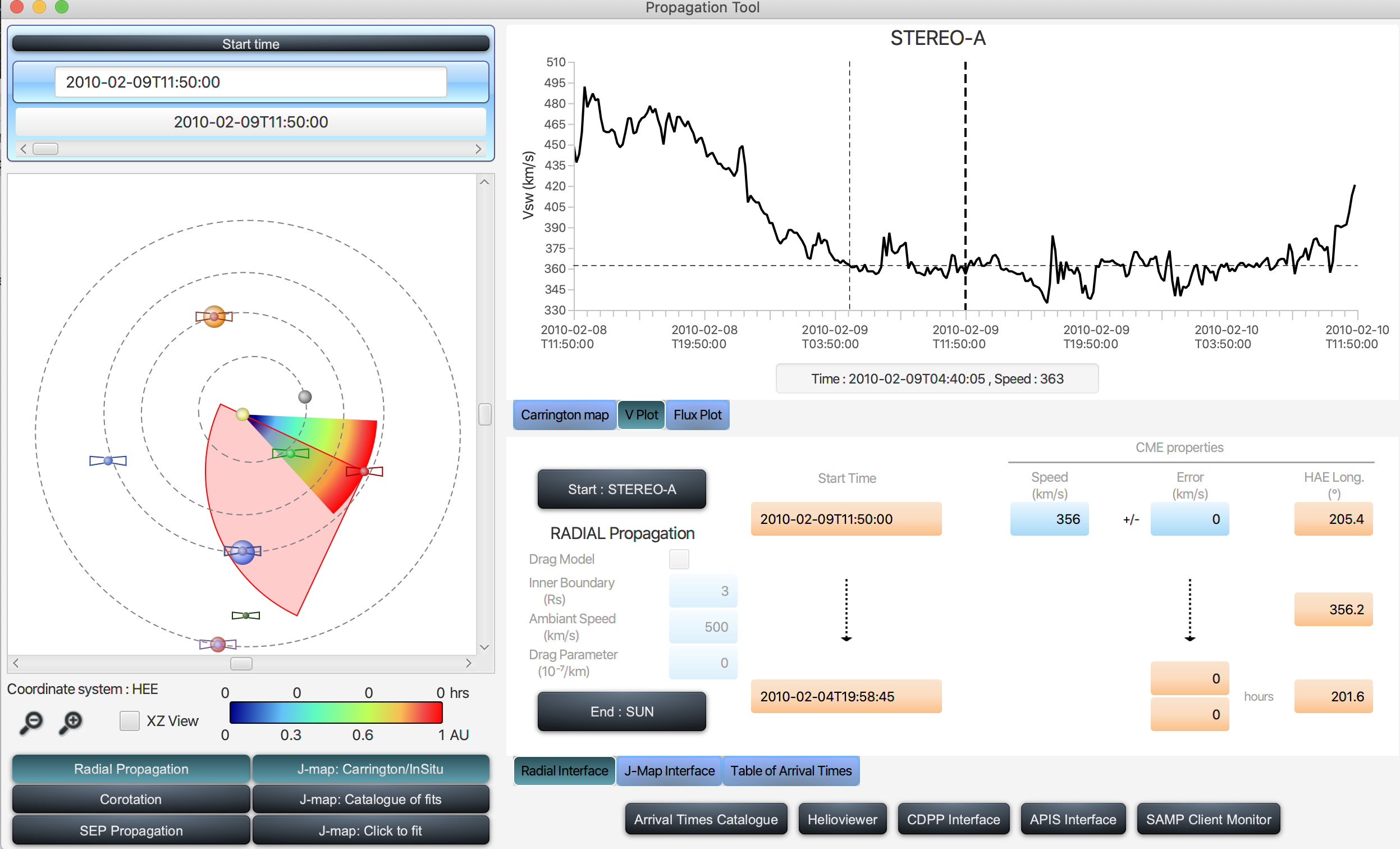
to propagate solar eruptions (CMEs) radially sunward or anti-sunward (Radial Propagation),
to propagate corotating structures (CIRs) in the heliosphere (Corotation),
to propagate solar energetic particles along magnetic fields lines sunward or anti-sunward (SEP Propagation),
The START and END points can be the Sun, planets or probes situated in the interplanetary medium. The times of propagation between the START and END points are based on simple analytic calculations.
The added values of the tool are an easy access to unique datasets and a fast interoperability :
it integrates the orbital elements (using SPICE) of probes and planets. This allows you to determine via simple clicks the position/orientations of imagers that you would like to consider,
it offers web-service access to summary plots of in-situ data stored at the CDPP as well as movies of solar images stored at MEDOC,
it provides access to a wide range of Carrington maps of the solar surface to visualize the location of active regions, coronal holes and solar flares on the Sun
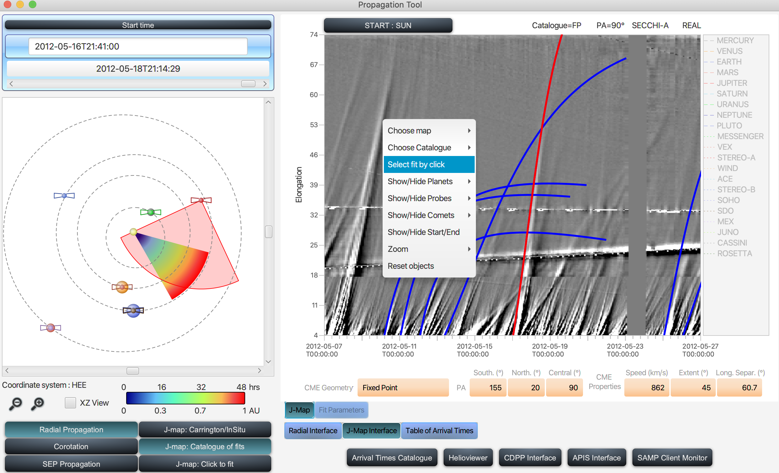
The great novelty of the tool is the immediate visualisation and basic manipulation of maps of solar wind mass flows tracked continuously from the Sun to 1AU. These maps are called J-maps and are generated by extracting bands of pixels in coronal and heliospheric images along the ecliptic planes and stacking them vertically (along the ordinate) with time (along the abscissae). The maps are produced from teraoctets of imagery data that are impossible to manipulate if you are not an expert in the field. The tool was designed to be user friendly and accessible to any scientist interested in locating CMEs/CIRs and particle fluxes in the ecliptic plane.
With the tool you can use these maps to:
cross check your ballistic calculation of CME/CIR propagations,
carry out your own calculations of CME/CIR trajectories in the ecliptic plane via a few clicks on the map (simple use),
use pre-calculated CME trajectories to check if a transient emerged from the Sun and impacted a planet or probe